
Everest GPS
Get ready for your outdoor adventures

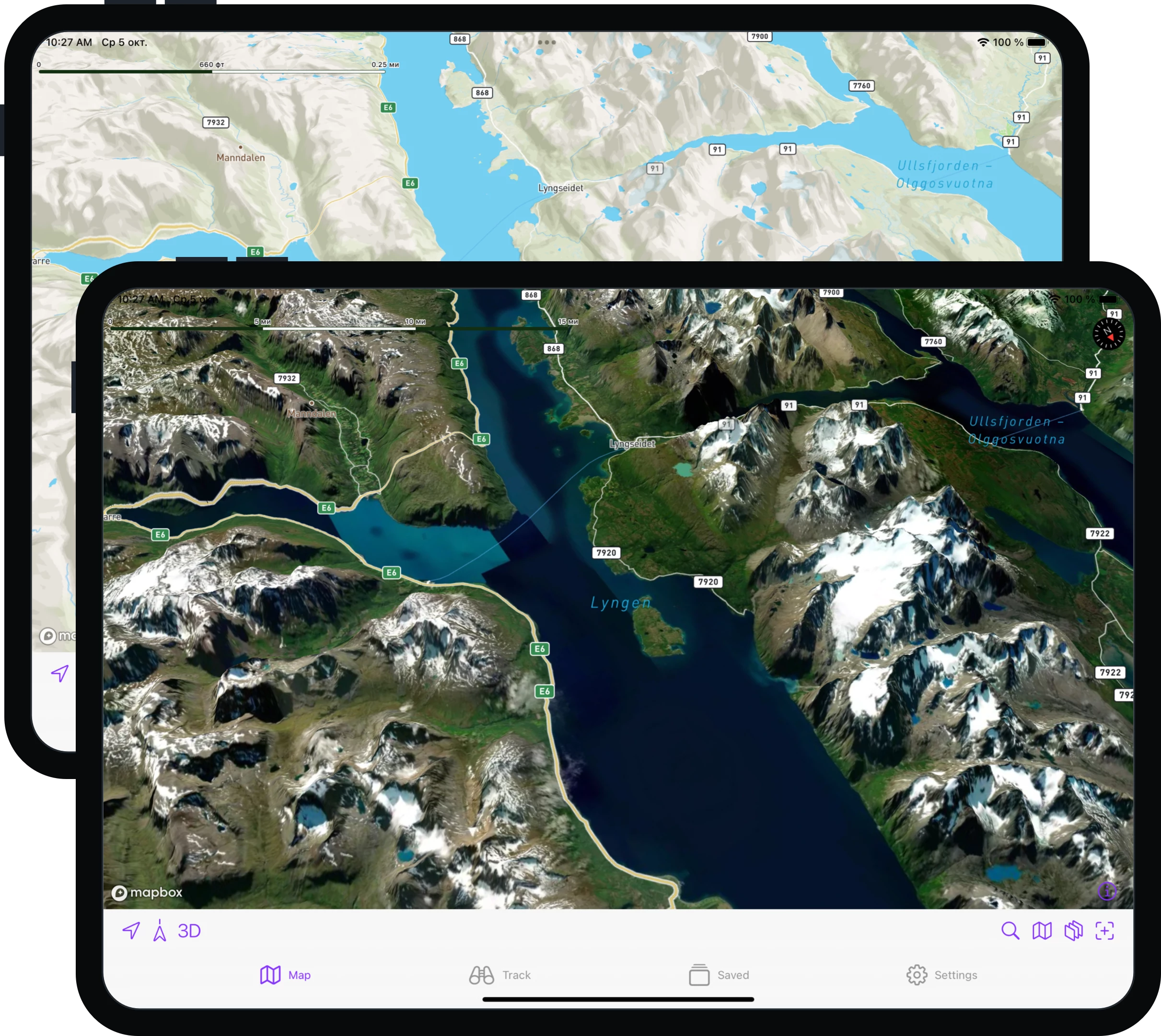
Stunning cartography
Everest GPS comes with high-quality detailed satellite and topographic 3D maps, which can be easily downloaded for offline use. Whereas other maps and navigation apps are designed for cities and roads, Everest GPS is packed with all the necessary features for your outdoor adventures.
Get ready for your next adventure
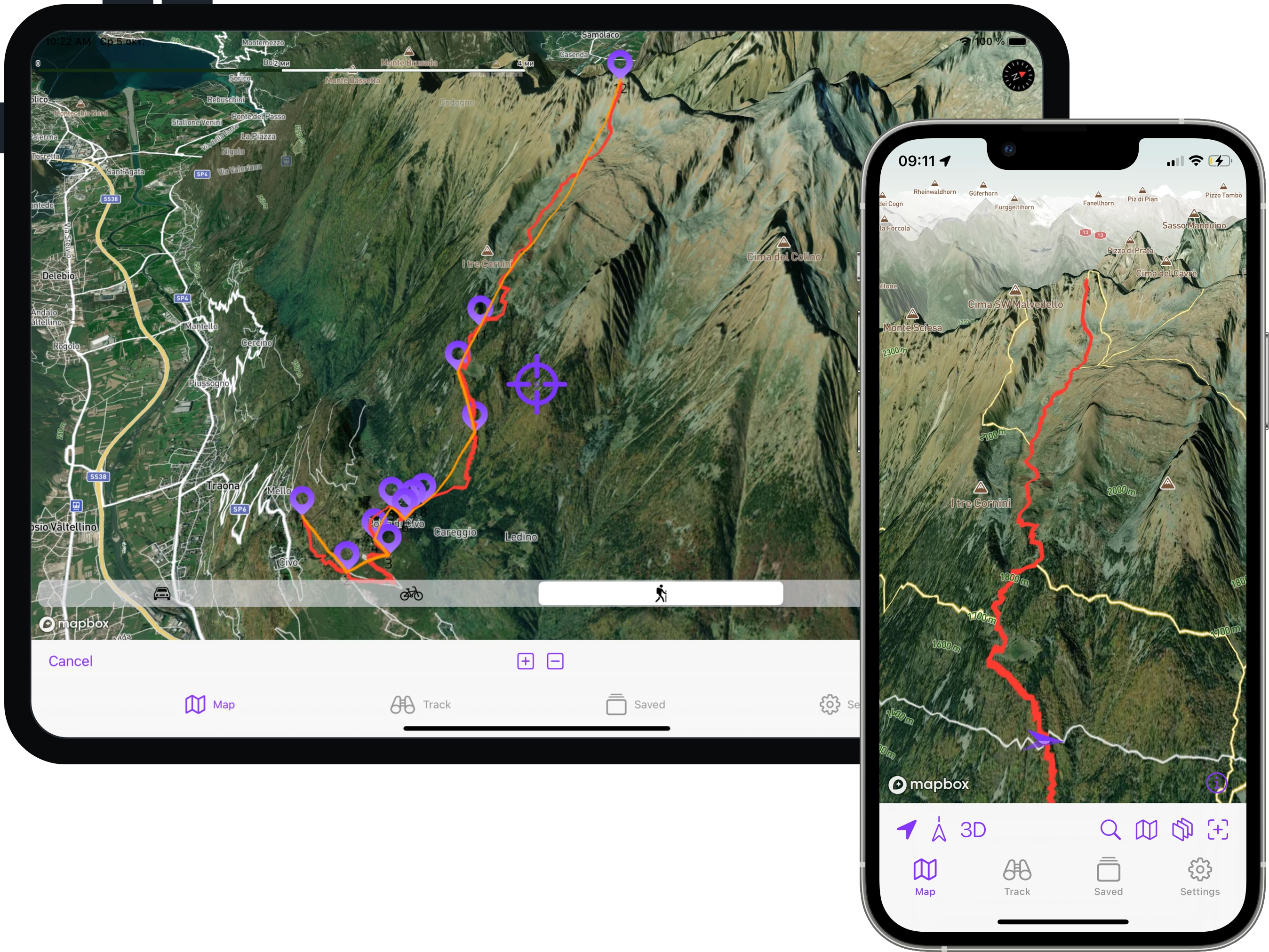
Everest GPS is an incredibly powerful route planning tool. Just zoom in, set points along your desired path and Everest GPS will automatically route the most optimal path using the profile you choose (hiking, cycling, or driving).
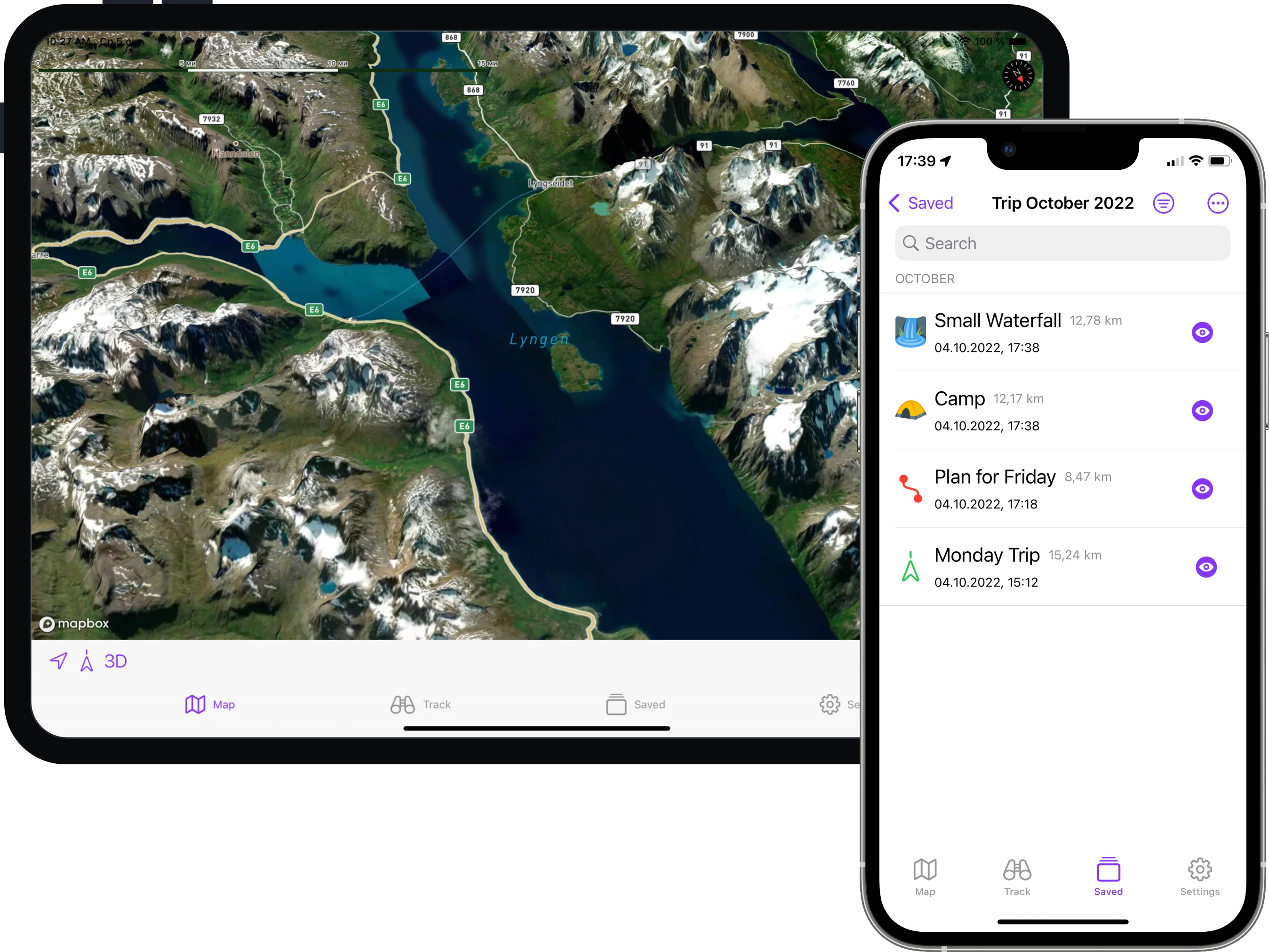
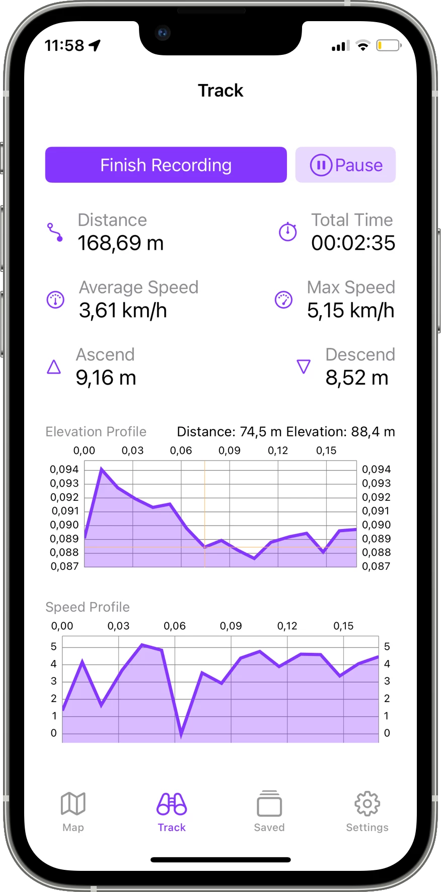
Understand Your Trip & Timing
Everest GPS comes with a powerful track recorder. Simply start recording when beginning your trip. All GPS data including distances, speed, and elevation will be saved.
Get ready for your next adventure
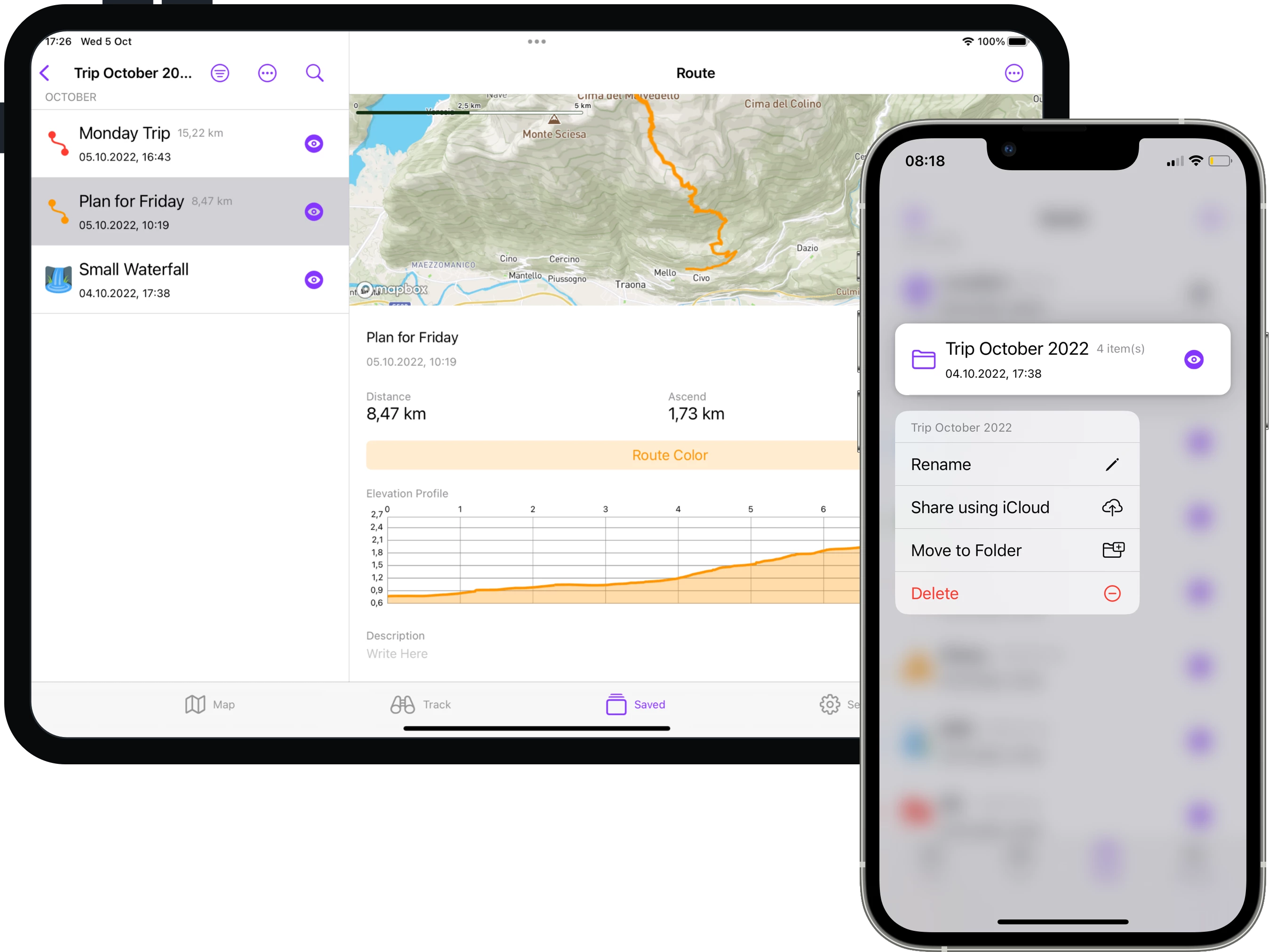
Planning your adventure with someone else? Everest GPS makes it easy to share data with your companions. Touch and hold your folder and share your routes, tracks, and waypoints with other Everest GPS users using iCloud sharing. If your companions use another app, you can simply export and share an industry-standard GPX file via email, messages, or any other app you have on your device.